After finding our John Gough and his wife, Susan McCloskey, in the 1861 Philadelphia city directory, we next needed to figure out where he was living. Nonnater’s Court, the name of his street in the directory, doesn’t exist anymore. So where exactly was it? I searched online using multiple search terms and phrases, but Nonnater’s Court didn’t turn up.
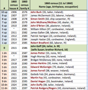
To figure out where it was, we went back to John and Susan’s listing in the 1860 census and then listed their neighbors on a spreadsheet. To make sure we had enough data points to figure out the location, we copied the 30 heads of households who appeared in the census before John and Susan as well as the 30 heads of households listed after our Goughs. This list was done in sequence to recreate their neighborhood.
I did this in an Excel spreadsheet. Here’s a snippet of what it looks like:

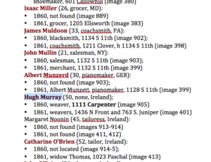
We sorted the names alphabetically in a Word doc to make it easier and quicker to search the city directories. (You could also just use another Excel chart – I find it a bit easier to navigate Word than Excel when I’m doing basic data input but Excel would be fine, if you prefer it.)
Here’s what the Word doc looked like:

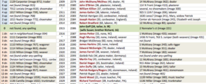
Once all this information was put back into the Excel spreadsheet of John Gough’s census neighbors, the patterns really started to emerge. Here’s a snippet. (Remember, there were lots more names than just these!)

Now all we had to do was figure out where these other streets were back in 1860. Clearly Nonnater’s Court was near Milton and Camilia in 1860, but they also looked like the names changed by 1861 (to McAlravy and Miller).
To clear all this up, more online research was needed. Next step, finding a map of Philadelphia from the 1860s online…
