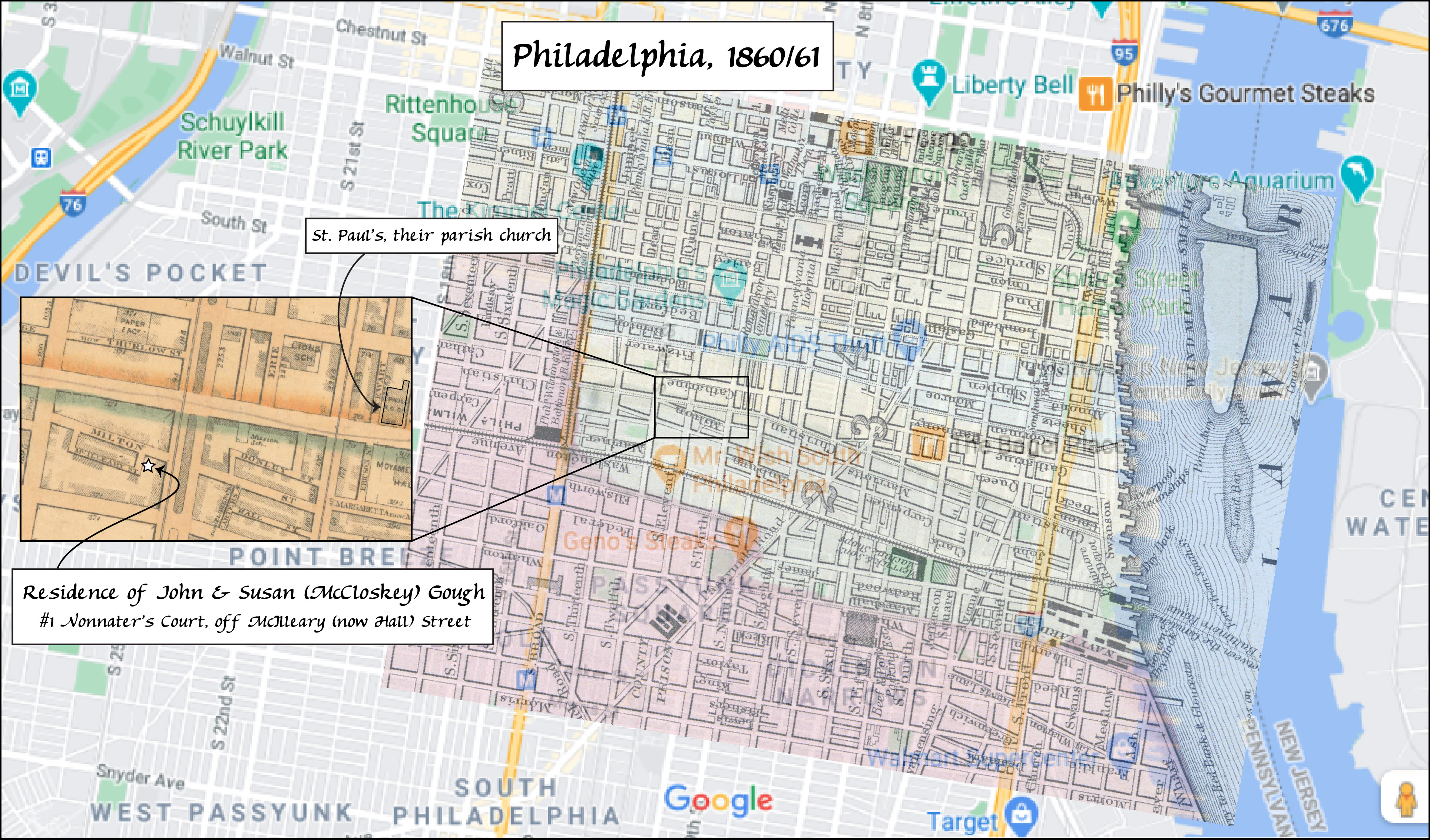
You may have noticed the map of Philadelphia on John Gough and Susan McCloskey’s family history page. Here it is:

This was a fun map to make because it incorporated three different maps, one modern image (the backdrop map) and two historical maps that were available online.
The first step in making any historical map showing where your ancestors lived starts with the obvious one of figuring out where exactly they resided at a given time.
John lived in Hazleton for most of his life after coming to America as a 15-year-old with his parents. But in 1860 he was listed in the census as living in Philadelphia. I knew this was “our” John Gough for several reasons: he was born in Ireland about 1835; he was identified as a tailor by trade (as he was in later years in Hazleton); his apparent wife was named Susan; and his younger brother Richard, born in Pennsylvania, resided with him. Bingo, all these fit with other sources we’ve found for our Gough family.
But the street where John Gough lived wasn’t given in the census that year, as was generally the case in later censuses. Fortunately, city directories were published for many larger cities and towns, including Philadelphia. And FamilySearch has digital versions that are searchable online for free.
John was listed in the 1861 M’Elroy’s city directory (published in January 1861), and his address was given as #2 Nonnater’s Court.
But where is Nonnater’s Court? It isn’t listed in any modern map of Philadelphia at all. It’s obviously in one of the older parts of the city, but Philadelphia was the largest city in colonial America and continued to be a major-sized city through the 19th century.
To figure that part out meant going to the census again…
