I’m starting to experiment with different ways of letting people navigate around this website, especially as new family groups and new generations of people are being added. The challenge is that a navigational menu on the sidebar or top could end up being so long that it’s hard to deal with on a phone or iPad.
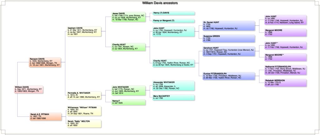
So I’m going to try posting ancestor charts for each of my great-grandparents so that visitors can see who’s where, in addition to gradually adding all-name indexes (with hyperlinks) to let you get where you want to go in the website.
I don’t know how to embed the hyperlinks into the charts themselves so will list the families on each page underneath the chart.
The first chart is for William Davis. I’m still adding pages with information on generations and families, so please be patient!
Click here to view the PDF in a larger format (or click on Download):


